
Modeling Habitat Connectivity for the Monarch Butterfly among Protected Areas and its Significance in Conservation
Maxent
The Maxent software will be used to analyze climate projections for future species distributions and how this will alter habitat connectivity. The environmental variables I will be using is precipitation, temperature, bioclim, as well as a set of georeferenced occurrence locations. This will produce a model of the range of the given species. For the current and projected climate change data I will be using the same environmental variables: min. temperature, max. temperature, precipitation, and a set of bioclim (1-19) data. Current projections include representation from 1950-2000. Future projects will be split into 2050 and 2070 climate predictions. Future conditions are modelled under IPCC AR5 because it is the most recent and policy relevant model. The scenario I chose was rcp8.5 because it is the most commonly cited in the literature. It is a scenario that describes increasing greenhouse gasses over time. The extent of the data is in region B2 only, which excludes most of the globe expect my study are of Mexico.
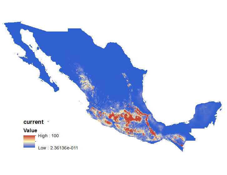
Monarch distribution data was obtained from citizen science observational records from 1980-2015 (Figure 9). The export feature attribute to ASCII tool was used in ArcMap to filter out unneeded records and keep only species, longitude and latitude data to be put into an excel data sheet. A total of 1,579 observations were used in this study. Each environmental variable data (min. temp., bioclim data, etc.) needed to be clipped from the global data to just the study area of Mexico. The extract by mask tool was used for each variable using the Mexico boundary layer shapefile as the area to be clipped to. The monarch distribution data was also clipped to this shapefile. The results are shown directly below (Figure 8).

Figure 8: Species distribution map of Danaus plexippus
A species distribution map was created using current monarch distributions to extrapolate future geographic ranges using the Maxent software. The current distribution is shown as well as 2050 and 2070 into the future. From the map we can see the current distrubtions that centers around Michocan, Mexico starts to move to the coast and further up north where the protected areas are no longer in use.
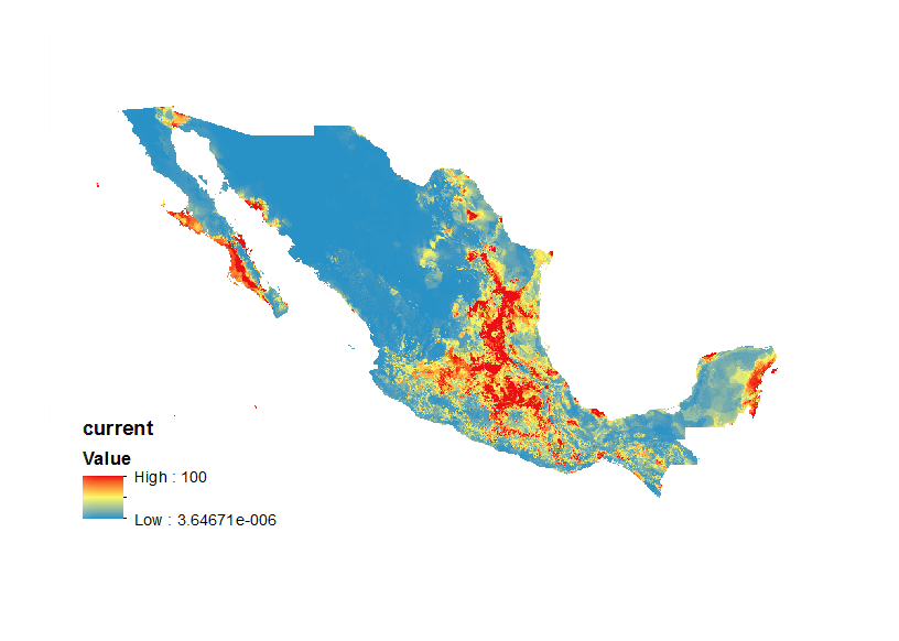
Figure 9: Monarch distributions
Recorded citizen science observations were collected from 1980-2015 from GBIF and converted from csv format to points, clipped within Mexico. This is the first step in creating a species distribution map for current and projected climate change data with Maxent.
Figure 9: Species distribution map of Abies religiosa
A species distribution map was created using current A. religiosa distributions to extrapolate future geographic ranges using the Maxent software. The current distribution is shown as well as 2050 and 2070 into the future. From the map we can see the current distrubtions that centers around Michocan, Mexico starts to get more sparse as time goes on.